Route Mapper app for iPhone and iPad
Developer: little-h ltd.
First release : 31 Aug 2012
App size: 5.42 Mb
Plan and measure your walking, running or cycling routes by drawing them on the map with your fingertip! Trace your daily walking tours while traveling, see how much you walked during a round of golf, or plan your practice route for triathlon, whatever is your thing.
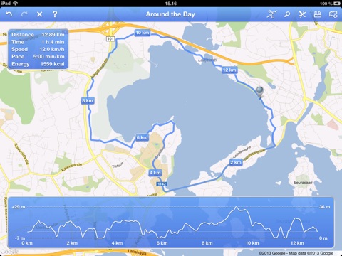
The intuitive user interface allows you to enter the route both by drawing freehand and by plotting the waypoints. You will immediately see the distance, milestones, total time, the average speed and pace, and how much calories are burned. Viewing the elevation profile allows to spot the uphills and downhills along the route. You can store your favorite routes for later use or you can share them with your friends via email.
You can choose between Apple Maps and Google Maps for the best possible coverage and accuracy (only on iOS 6+, though). Freehand drawing on the satellite imagery allows easy measuring of arbitrary routes, even when you are hiking on trails that are not shown on maps or running on the beach. For fast and easy plotting of routes along roads and pathways, waypoints can be made to trace roads on the map automatically.


